Prospect like you've got a geology department.
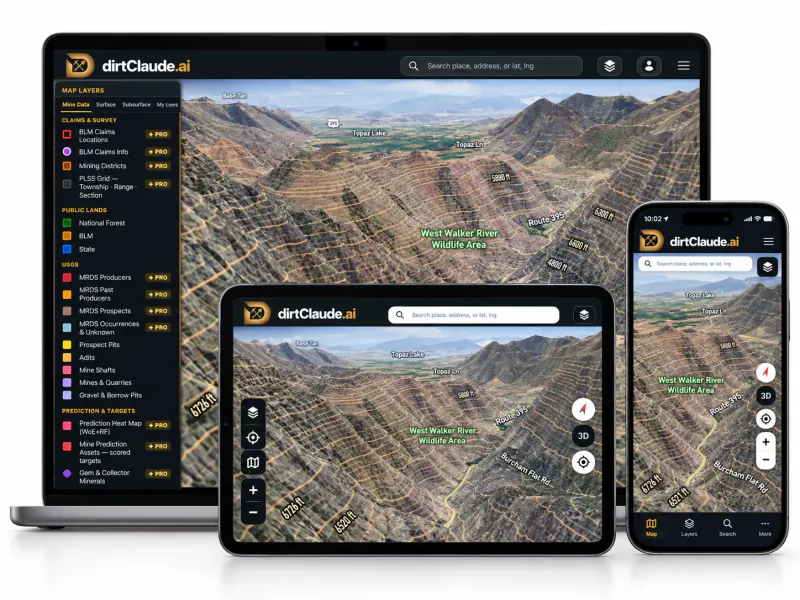
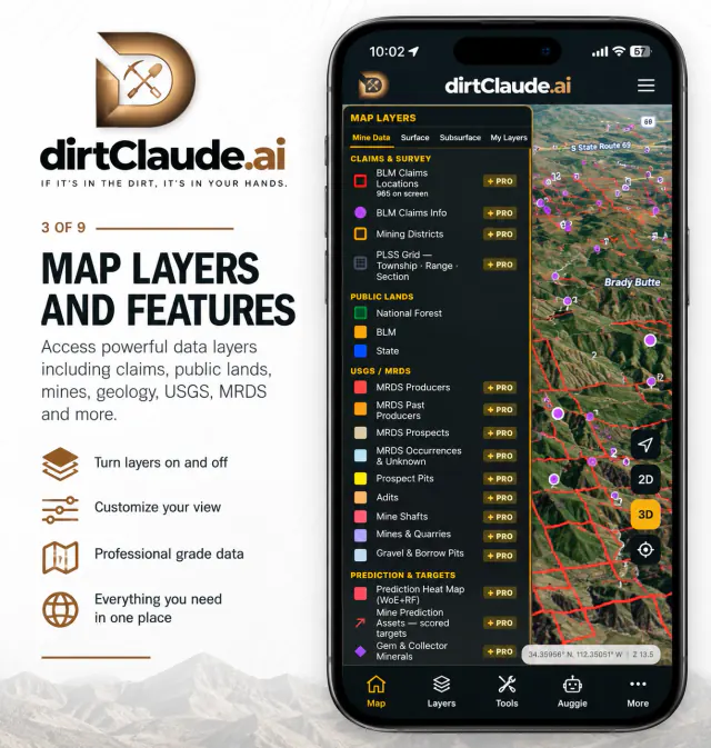
Live BLM Claim Status ✦ Pro
Claim polygons from BLM MLRS — red is claimed, open ground isn't. Township claim counts from zoomed out, section-by-section detail as you close in, the PLSS grid down to quarter sections, and the listing behind each one — holder, serial and fee date. Know the ground before you drive out.
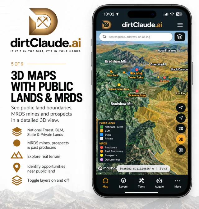
Public Lands & Surface Ownership
Who manages the ground, straight from BLM's federal Surface Management dataset: National Forest in green, BLM in gold, state land in blue — the first question of every claim-staking plan, answered at a glance.
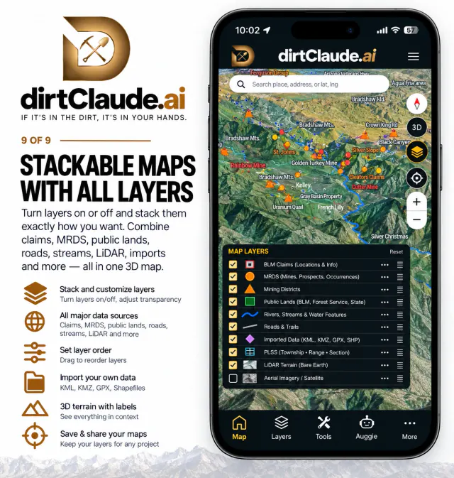
149k+ Mine Records ✦ Pro
The full USGS MRDS record on the map, plus the state surveys' own mine records — historical mines, prospects and occurrences. Hold for the summary, tap through to the source record: commodities, production years, references.
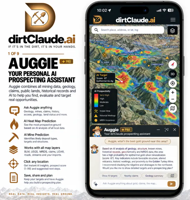
AI Prediction Heat Map ✦ Pro
A WoE + Random Forest hybrid scores any point from 1–99 — each state against its own mine records, districts and placer workings. The heat surface shows where the geology lines up; the scored targets and known quartz veins show exactly where to look first.
Auggie — Claude-powered geologist ✦ Pro
Ask about any spot and Auggie answers from the live layers under your cursor — claim status, what's underground, the mine or feature you just tapped, and the prediction score — grounded in USGS, BLM and the state surveys themselves, not vibes. Included with Pro Monthly (3 questions/day) and Pro Yearly (5/day); not part of Weekender Pro.
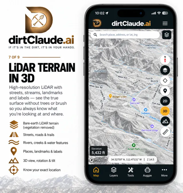
LiDAR & 3D Terrain ✦ Pro
USGS 3DEP hillshade (~1 m wherever the LiDAR has been flown) and slope steepness reveal old workings, trenches and tailings the satellite view hides — as overlays, or as the LiDAR, LiDAR Roads and Topo 3D basemaps. Tilting any basemap into 3D terrain stays free.
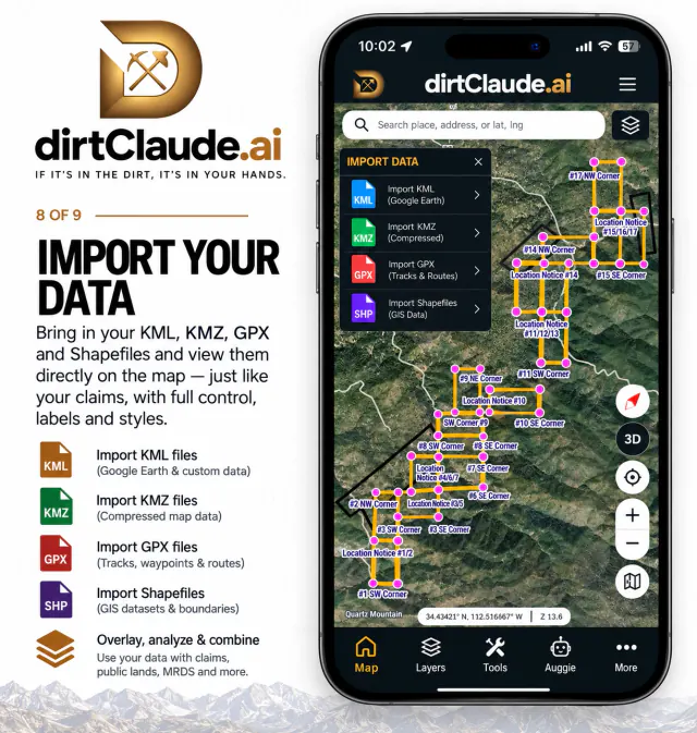
My Layers — your own maps ✦ Pro
Draw points, lines and areas, or import KML, KMZ, GPX, GeoJSON and shapefiles, and see them on the map with the claims, public lands and mine records. Export any layer back out as KMZ, KML, GeoJSON or GPX. Your layers stay on your device.
What's Underground
Double-click the map for the depth to water at the nearest measured well — 118k+ state-agency and USGS wells — plus caliche, bedrock and hardpan in the top few feet from the NRCS soil survey. Where no record covers the spot, the card says so instead of guessing. Free, separate from the Pro Subsurface tab.
State Subsurface ✦ Pro
Toggleable layers from the state surveys' own science: state geologic maps, active faults by age, hydrographic & groundwater basins, geothermal, gravity & aeromagnetics, and oil, gas and water wells — the third dimension under your boots.
Offline Maps & GPS Field Kit
Downloadable field packs for off-grid prospecting, GPS breadcrumbs, waypoints and GPX export — mark the dig, walk the wash, keep the evidence, no signal required.