Best Software for Managing Multiple Exploration Sites
Compare software for managing multiple exploration sites. See which features matter for claims, mapping, field data, and multi-site visibility.
Read the article dirtClaude✺AI
Log in
What's new on the map, for prospectors and rockhounds.
Compare software for managing multiple exploration sites. See which features matter for claims, mapping, field data, and multi-site visibility.
Read the articleModernize subsurface geology data analysis with a step-by-step workflow: digitization, 3D mapping, machine learning, and quality control. Start here.
Read the articleHow a new claim gets from stakes in the ground to BLM's records, why the newest claims are usually Filed, how to tell a company block from scattered prospectors, and how to find fresh filings on the map before you plan a trip.
Read the guideWhat each status in BLM's MLRS actually means, why a Filed claim still holds the ground, why Closed doesn't mean open, how the September 1 maintenance fee fits in, and how to check a claim before you dig, detect or stake.
Read the guideArizona's proven gold districts, from Lynx Creek and Rich Hill in the Bradshaws to La Paz near Quartzsite, Vulture and Oatman, backed by USGS and AZGS records. Plus where panning is actually legal, why State Trust land is off limits, and how to check a spot for claims before you drive out.
Read the guideNot everyone needs a subscription. If you're heading out for a weekend, Weekender Pro unlocks every Pro feature for 72 hours for a one-time $1.99. That covers claims, the PLSS grid, MRDS mine records, predictions, geology, LiDAR and the Subsurface tab. It never renews, and buying another pass adds 72 hours.
If you like it, upgrade while your pass is running or within 7 days after it ends. Your first month of Pro Monthly or first year of Pro Yearly then costs $1.99 less, so the weekend ends up free.
Auggie, the AI geologist, is now part of the subscriptions only: 3 questions a day on Pro Monthly and 5 on Pro Yearly.
Compare the plansThe silo layer used to show only Titan II sites: the 18 Arizona complexes around Tucson and three test silos at Vandenberg. It now adds the Titan I generation. That includes the three Beale AFB complexes in Northern California (851-A, 851-B and 851-C) and Vandenberg's 395-A complex, OSTF-8 and the Silo Launch Test Facility. The layer has a new name too: Underground Missile Silos. Tap a site for its missile, squadron and service dates.
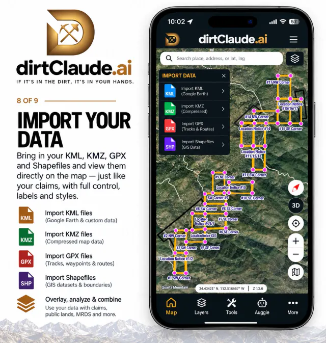
My Layers already read KML, KMZ, GPX and GeoJSON. It now opens Esri shapefiles
as well. Pick a zipped shapefile, or select the .shp together with its
.dbf and .prj. Claim boundaries, survey
lines and sample points from a GIS or a county download appear on the map with their
attributes, in the right place.
As with everything in My Layers, the files stay on your device. You can export them again to KMZ, KML, GeoJSON or GPX.
The meteorite layer now comes from the Meteoritical Bulletin. Each meteorite is placed where it was found and labelled with the county at that point. The layer also draws strewn fields. A strewn field is the area where the pieces of one fall came down.
Before you hunt, check the land status. BLM, National Forest, state and tribal land each have their own rules on collecting meteorites.
Zoom in past the section lines and the PLSS grid now splits each section into quarters, labelled NE¼, NW¼, SW¼ and SE¼. Claim paperwork, BLM records and county maps describe ground by quarter section, so you can now read a legal description straight off the map.
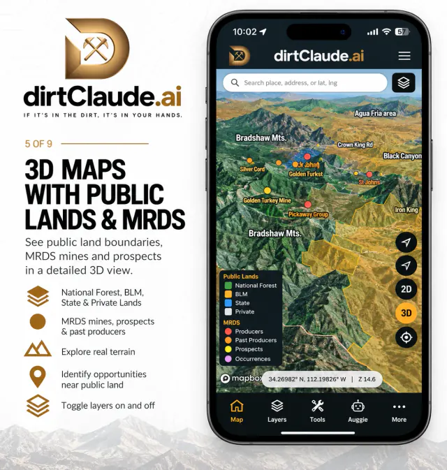
The map now covers more ground. BLM claims, land ownership, MRDS mines, geology, faults, water and LiDAR carry on across state lines, each drawn from that state's own sources: its geological survey for geology and its water agency for water. There's no state picker. Pan across a state line and the map follows.
Open the map